
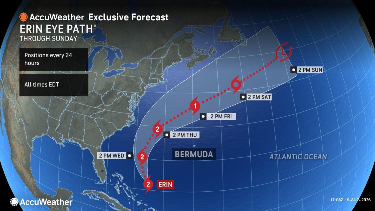
AccuWeather hurricane experts say wind gusts from Hurricane Erin are forecast to affect parts of the mid-Atlantic coast and southeastern Massachusetts later this week as the storm moves north.
“People should follow evacuation orders. Hurricane Erin is expected to bring direct impacts to parts of the Outer Banks with 40-to-60-mph wind gusts, several feet of storm surge and waves reaching 15-20 feet. Coastal flooding and surge could wash away dunes and leave roads submerged,” AccuWeather Lead Hurricane Expert Alex DaSilva warned. “These dangerous conditions could leave roads impassable for days, making rescues and evacuations nearly impossible. Some beach houses in areas battling beach erosion could be damaged or even collapse into the rough surf this week.”
AccuWeather hurricane experts say wind gusts of 40-60 mph are expected to begin as early as Wednesday night across coastal areas of North Carolina, including the Outer Banks, as well as parts of southeastern Virginia, including Virginia Beach. The AccuWeather Local StormMax™ is 80 mph.
Hurricane Erin is expected to make its closest approach to the U.S. coastline on Thursday. Some rain showers are expected along the mid-Atlantic coast Thursday morning. Gusty winds and very rough surf will pick up along the Outer Banks Thursday afternoon into Thursday night.
Wind gusts of 40 to 60 mph are expected Thursday evening into Friday across parts of southeastern coastal Massachusetts, including Cape Cod.
Due to rain, wind and surge, Erin is a less than one on the AccuWeather RealImpact Scale for Hurricanes in the Caribbean, United States, Bermuda and Canada.
A rating of less than one on the AccuWeather RealImpact Scale for Hurricanes indicates limited damage potential from wind and rain, as well as some coastal inundation capable of causing property damage.